Got a tip for us?
Let us know
Become a MacRumors Supporter for $50/year with no ads, ability to filter front page stories, and private forums.
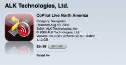
ALK Copilot for North America is OUT!! YES!
- Thread starter tivoboy
- Start date
- Sort by reaction score
You are using an out of date browser. It may not display this or other websites correctly.
You should upgrade or use an alternative browser.
You should upgrade or use an alternative browser.
Wow that is a really really compelling price.
Too bad I have read it isn't as good as Navigon or iGo MyWay...
For those of you who pick it up. Is this true?
If so, I think a couple of updates might make it a real contender anyway.
Too bad I have read it isn't as good as Navigon or iGo MyWay...
For those of you who pick it up. Is this true?
If so, I think a couple of updates might make it a real contender anyway.
OMMMG!! Another contender! I was about to purchase Navigon tonight till I saw this! No reviews yet, but the price is really competitive  I wonder how this goes with respect to the other TBT apps, so far high-par based on the reviews. Someone please do a review, it's now tougher to decide what to get.
Update: What's the use of the CoPilot Central? Is that software really needed to activate the app? Somehow their User Guide doesn't include the iPhone version, only for Windows Mobile Phones or an Android.
I wonder how this goes with respect to the other TBT apps, so far high-par based on the reviews. Someone please do a review, it's now tougher to decide what to get.Update: What's the use of the CoPilot Central? Is that software really needed to activate the app? Somehow their User Guide doesn't include the iPhone version, only for Windows Mobile Phones or an Android.
Update: What's the use of the CoPilot Central? Is that software really needed to activate the app? Somehow their User Guide doesn't include the iPhone version, only for Windows Mobile Phones or an Android.
CoPilot Central is not used by the iPhone version of the app. It only applies to the Windows Mobile version. The user manual is generic for all versions of CoPilot which is why it's mentioned.
CoPilot Central is not used by the iPhone version of the app. It only applies to the Windows Mobile version. The user manual is generic for all versions of CoPilot which is why it's mentioned.
Ahh I see. Somehow got confused since there were parts saying you could update easily your maps using central blah blah..
This app really got my attention based on UI and color presentation alone. I just want to know how good it works on re-routing and how fast it picks up your location if you were interrupted by a phone call.
The menus are good, but do you really prefer that UI to say, navigon?This app really got my attention based on UI and color presentation alone.
Check the Co-Pilot info on the PocketGPSWorld.com chart:
http://www.pocketgpsworld.com/iphone-navigation-app-comparison-xr5133.php
Are map updates going to be free or for a fee (likely)? Although the initial price is low, over the course of 12-18 months it basically evens out with something like iGo MyWay, which I like better.
EDIT: Also, can anyone confirm that it does NOT resume your destination after relaunch as the chart says? That would be a deal breaker for me. Getting a phone call or getting kicked out only to have to enter everything back in would be a huge pain.
nope, it does not remember your route. it will after an updateEDIT: Also, can anyone confirm that it does NOT resume your destination after relaunch as the chart says? That would be a deal breaker for me. Getting a phone call or getting kicked out only to have to enter everything back in would be a huge pain.
Looks interesting. I like the UI. Would definitely like to see some users post up their experiences, or if someone finds other links to reviews (iPhone version specific).
A couple of things that stand out (for me anyway) is the ability to directly enter a destination based on latitude/longitude, and the easy to read text.
One of particular interest (from reading their documentation), is the GPS signal lock time. In their CoPilot Live for iPhone - Overview & FAQ it states that initial GPS signal lock can take up to 5 minutes....um......really....5 minutes? That's not really usable. Anyone anywhere using CoPilot Live experienced these GPS signal Lock times ?
A couple of updates could certainly make this a great buy (and will be interesting to watch how the other TBT software/hardware companies react).
Have they mentioned anything about updates and pricing? Or, maybe someone has experience with them before their iPhone app?
Another exciting addition to the Navigation panoply of apps.
As I've said elsewhere, I think that within the next couple of months when all these programs have done their updates, functionality will be quite similar.
I think it comes down to the user interface, things like people saying that Navigon is too hard to read or that Copilot an iGo are too busy and video game like.
As well, the time to load and retention of GPS signal are crucial.
Anyone with comments on these two issues would be very welcome.
They are all going to be able to do the same things soon enough, but which ones are a 'joy' to use, ie: easy to read and intuitive to use?
maybe it's just me
but I only see 1 review great price honestly the price GPS Apps should be $50-$60 bucks tops Tomtom i crazy imo.
the uk app has several reviews
but I only see 1 review great price honestly the price GPS Apps should be $50-$60 bucks tops Tomtom i crazy imo.
I see over 10 pages worth of reviews?but I only see 1 review great price honestly the price GPS Apps should be $50-$60 bucks tops Tomtom i crazy imo.
I think that's one of the biggest decision points for me - which company is likely to deliver on a long-term basis. Which ones have the resources in terms of personnel, strategy, capital, etc. to actually deliver a significant product over time.
From what I've been able to find out thus far, excepting Tom Tom, Navigon is the biggest in terms of company size, followed by NavNGo (Igo) and ALK. Interesting to note, ALK (Princeton, NJ) is the only company (including Tom Tom) headquartered in the US.
Looking at the ALK website, while they use Navteq for the European maps, they have their own proprietary North American map database. I'm curious whether this is the one used in the iPhone application. They also mention that the map database is augmented by customer information from GPS trip tracks. Does this 'phone home' somehow?
Here is a review of the Android version of Co-Pilot North America:
http://androinica.com/2009/07/15/ap...roid-voice-navigation-in-the-right-direction/
http://androinica.com/2009/07/15/ap...roid-voice-navigation-in-the-right-direction/
WM version
I think this is just going to be quite close to the Winmo versions that this company has been making for over eight years for the mobile platform. So, a recent review of one of those versions is going to be pretty good.
Historically, the "central" product and "live" product allowed one to release their location and it would be carried over the cell phones data services, so that you could allow others to VIEW your location on a map, they could send you direct messages and you could reply back. It was neat and novel, back in 2003-2004, but today I think it can be replicated.
As for paid maps, not sure if they will update or be paid. Historically, ALK updated their own maps, about once every 2 - 2.5 years or so?
Once I download, I'll do a little testing today.
I see over 10 pages worth of reviews?
How can you compare the two? the UK version has lane assist and reality view for highway signs whereas the US version doesn't. This is a huge difference, i wonder what else got stripped out of the US version.
Interesting - it does appear to be different. Not sure if they left that out by mistake or whether it really is not there. That would be a huge difference:How can you compare the two? the UK version has lane assist and reality view for highway signs whereas the US version doesn't. This is a huge difference, i wonder what else got stripped out of the US version.
North America

UK

Interesting - it does appear to be different. Not sure if they left that out by mistake or whether it really is not there. That would be a huge difference:
I doubt that it's an oversight. Even the screenshots in the app store show the lane assist/reality view for the uk version but not for the us version.
Also, another huge difference is that the UK version uses navteq maps whereas the US version uses "proprietary" maps.....i would rather go with navteq maps then some proprietary maps from a small company.
Interesting - it does appear to be different. Not sure if they left that out by mistake or whether it really is not there. That would be a huge difference
Oh, sorry, i didn't realised they would leave out such a useful feature...
Interesting - it does appear to be different. Not sure if they left that out by mistake or whether it really is not there. That would be a huge difference:
North America
UK
Most likely because that's a feature of the maps database and their "proprietary" NA maps probably don't contain the necessary data.
Exclusion of the lane and signpost features is almost assuredly due to the proprietary North America map set that ALK uses. In the European/UK version, those maps are provided by Navteq and the lane information is included. The ALK North American maps probably don't have that info, thus they can't display it.
That brings up a number of questions as to what else is excluded from their database - thus not allowing for more advanced features. Using a proprietary database also raises concerns about the maps' accuracy, and frequency of update.
Exclusion of lane information features is enough for me to exclude this as a viable purchase solution. The unknown about map quality and updates also leads me to shy away from this, even at the discounted price. For some these may not be deal-breakers - for me they are.
Map updates
As far as map updates go, historically with the winmo products one could CHOOSE to upload "tracks" to the company which would help them better their map database. I have always done this. I thnk it must be annoymous though. I don't thinkthe iPhone will technicallly phone home though.
As far as map updates go, historically with the winmo products one could CHOOSE to upload "tracks" to the company which would help them better their map database. I have always done this. I thnk it must be annoymous though. I don't thinkthe iPhone will technicallly phone home though.
As far as map updates go, historically with the winmo products one could CHOOSE to upload "tracks" to the company which would help them better their map database. I have always done this. I thnk it must be annoymous though. I don't thinkthe iPhone will technicallly phone home though.
still gives me the hibbie jibbies. there is no such thing as "anonymous" if they really want to match a track to a specific device. also, consider everyone who might choose to use the useless feature that lets others with the same program know where you are, this means they surely are linking locations/tracks to specific devices/phones.
gives me pause
Register on MacRumors! This sidebar will go away, and you'll see fewer ads.