Got a tip for us?
Let us know
Become a MacRumors Supporter for $50/year with no ads, ability to filter front page stories, and private forums.
What do these weather icons mean?
- Thread starter Thomas.Matthews
- Start date
- Sort by reaction score
You are using an out of date browser. It may not display this or other websites correctly.
You should upgrade or use an alternative browser.
You should upgrade or use an alternative browser.
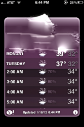
Thats not snow over a cloud. That is snow falling onto the ground and freezing, meaning a wintry mix/freezing rain.
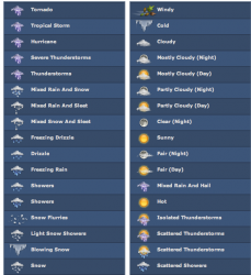
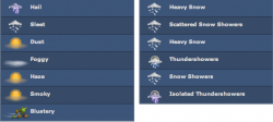
Here you go...I googled Yahoo weather icons list
http://macmost.com/iphone-weather-icons.html
Yours look upside-down to me!
http://macmost.com/iphone-weather-icons.html
Yours look upside-down to me!
Last edited:
A thread for this..? Really..?
The symbol in the OPs picture is for heavy/settling snow, which is to different from the light snow symbol in tjb1's post.
Also, this is different from the wintry showers/sleet symbol, which shows both snowflakes and raindrops.
Finally, it is not an upside down cloud.
Glad we cleared all that up.
P.S. Please don't put your fingers in electrical sockets either.
Wirelessly posted (Mozilla/5.0 (iPod; CPU iPhone OS 5_0_1 like Mac OS X) AppleWebKit/534.46 (KHTML, like Gecko) Version/5.1 Mobile/9A405 Safari/7534.48.3)
Freezing rain or slushy mix of way too much weather variance?
Freezing rain or slushy mix of way too much weather variance?
maybe it means significant snow accumulation? since it looks like snow falling on the ground?
I agree...snow falling to the ground!
Iphone weather symbol
Can someone tell me what the symbol for monday is? searched and searched and nothing https://forums.macrumors.com/attachment.php?attachmentid=322895&stc=1&d=1328264472
Can someone tell me what the symbol for monday is? searched and searched and nothing
Attachments
Yahoo iPhone weather icons.
Not true. These aren't the iPhone icons. Where, for instance is the hail icon from the above post?
I've done a long search and even been on the Yahoo! Developers' pages and can't find them anywhere.
Alexandraa, That looks like sleet.
No icon-based forecast would predict only hail. Hail is a product of intense generally warm-season thunderstorms so if, for some reason, hail was in the forecast you would see a thunderstorm icon.
Sleet is formed in an atmosphere where there is a warm layer well above the layer of sub-freezing surface air. Snow well aloft melts into rain in this warm layer, then re-freeze to sleet or ice pellets. Sleet bounces too, just like in the picture.
(Hail is formed by intense updrafts within a thunderstorm which pull raindrops well up to a sub-freezing layer a mile or so above the surface of the earth. The frozen drops fall as the updraft weakens, but are often pulled back up into the sub-freezing level by other updrafts, adding a layer of water/ice each time as the hailstone falling into the rain/cloud and then gets pushed back up over and over again. Sometimes this process (with very intense updrafts) can produce hail the size of a grapefruit or larger.)
And the OP's icon is heavy, accumulating snow...as Frosticus said.
Maybe there's a way to extract all the icons from the iPhone OS and then we could analyze.
There is a strict order to weather icons and it should be possible to deduce the meaing simply by the order in which they are listed or named.
There is a strict order to weather icons and it should be possible to deduce the meaing simply by the order in which they are listed or named.
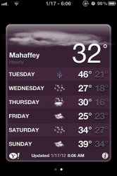
A lot of people been saying its hail, ive never seen it before its so weird..stupid cold rubbish weather 
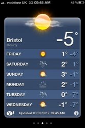
My weather reading for tomorrow has rain coming out of the sun on it. I will brace myself for fire and brimstone rain accordingly.
Picture

Picture

Last edited:
My weather reading for tomorrow has rain coming out of the sun on it. I will brace myself for fire and brimstone rain accordingly.
LOL. Ah yes, I have seen that one.
Can someone tell me what the symbol for monday is? searched and searched and nothinghttps://forums.macrumors.com/attachment.php?attachmentid=322895&stc=1&d=1328264472
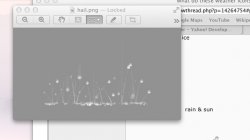
Hail you can see it better now
A lot of people been saying its hail, ive never seen it before its so weird..stupid cold rubbish weather
Not hail...Sleet or Ice Pellets.
Hail comes from thunderstorms. I'm a meteorologist...I should know.
Register on MacRumors! This sidebar will go away, and you'll see fewer ads.


