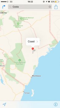
For those wanting to observe a bit of chatter related to what's here, the source -
http://www.justinobeirne.com/essay/what-happened-to-google-maps - has led to some banter over at Slashdot -
https://tech.slashdot.org/story/16/05/01/1634235/what-happened-to-google-maps - and IMHO it's a fun read. Fun, as I'm often working on cartography, from the design/layout and construction/documentation side of it.
I'm still sticking to waiting until MS and Apple get their new products out there for us to rail on, at least MS has a preview on the web - and I still see Bing and Apple cars driving around when I'm out on the road for work.
I'm not sick on Apple Maps, but rather Apple's still leasing TomTom's crappy Teleatlas mapping/traffic data (here in the US, and lots of locations in Europe) like Google used to do before hitting the road and buying Keyhole; Google's more or less slightly modified Keyhole's backend and search engine and IHMO this interface/parsing really hasn't changed in the 10-odd years since Keyhole, nee Google Earth, was assimilated by Google.
Teleatlas has been a PITA to work with since I got into GIS/mapping, over 20 years ago - the snarky line we use(d) is along the lines of if you're in NA, use NAVTEQ and if you're in Europe use Teleatlas. IMHO Google was smart to cut Teleatlas loose - my last TomTom GO cost a pretty penny, and I can still recall the panic in the voice of the tech with NAVTEQ when Google Maps came out, which I used on my Symbian S60 handset on that zippy ATTWS EDGE network

- but I had little empathy for NAVTEQ then as platted properties with new roads seemed to take 12-24 months to show up in their data, and I could get better maps from Thomas Guides (and still can, but it's hard to stuff them into my iPhone...).
Most of the readers here have no idea how bloody expensive it is to lease GIS data from the agencies I work with as NAVTEQ/HERE and Teleatlas have lowered their payments to agencies my rates for data have skyrocketed; it's cheaper for me to dispatch a survey crew than buy (then fix) outdated GIS data. I still find out of date POIs - including postal offices a mile or so away from where they've been for 50 years - so it's an arsenal of map apps for me! Cheers!


