Become a MacRumors Supporter for $50/year with no ads, ability to filter front page stories, and private forums.

IGI2

macrumors 6502a
Original poster
May 6, 2015
559
529
As promised, see how many roads are lacking in Apple Maps, newest iOS 10 GM maps on the LEFT, and real world on the right:
IMG_1147.PNG IMG_1146.PNG
IMG_1149.PNG IMG_1148.PNG
IMG_1150.PNG IMG_1151.PNG
IMG_1153.PNG IMG_1152.PNG
IMG_1158.PNG IMG_1159.PNG

So how can a person in Poland use Apple Maps? He can't. Only a die-hard fan can stand it...

With Apple Maps Poland looks quite de-urbanized.

And it's not only about the roads, but about terrain, forests, general orientation, lakes, school fields (first pair on top), fair distribution of trees, some perspectives.


And finally, a small comparison to Sygic (one-time purchase lifetime license for 15 EUR):


So I hope Apple will catch up, but THERE'S A LOT TO DO.
 
Zoom level does nothing? Since Maps was first introduced, people made comparisons like this and it was sometimes shown that Maps simply chose not to show the same detail at the same zoom level.
 
  • Like
Reactions: TurboPGT!
Zoom level does nothing? Since Maps was first introduced, people made comparisons like this and it was sometimes shown that Maps simply chose not to show the same detail at the same zoom level.
Oh boy, I wish it was that simple.

Zoom makes it worse ;) Look:
IMG_1169.PNG IMG_1170.PNG
IMG_1171.PNG IMG_1172.PNG

You see this BLANK space near the "Hanki Sawickiej" street? It's just sad :(
 
Well...parking lot detail is one thing...I don't think that is a fair comparison for most map programs.

But it is tough to beat Google or Waze when it comes to that kind of stuff.

But...you have the temperature in the corner!! Hah. I do love that feature.

I'm spoiled an live in the US where it is dramatically improved.
 
  • Like
Reactions: TurboPGT!
Well...parking lot detail is one thing...I don't think that is a fair comparison for most map programs.

But it is tough to beat Google or Waze when it comes to that kind of stuff.

But...you have the temperature in the corner!! Hah. I do love that feature.

I'm spoiled an live in the US where it is dramatically improved.
The second screen are normal roads.

And when it comes to the first screen, it's not just parking details, it's also roads, when Apple doesn't see them correctly, this happens:
navigation.png

It thinks you have to DRIVE 17 KM MORE than you should.
Zrzut ekranu 2016-09-12 o 11.25.54.png

It's like a major problem here :p

PS And I've reported it to Apple many times for the past 2 years ;)
 
  • Like
Reactions: timothevs
Small streets is one thing, but lack of highway sections???... it is crazy:)
I was driving from Wroclaw to Warsaw few days ago, and Apple Maps tried guide using really strange road. I like the look, directions in Apple Maps, but coverage... does not exist in countries like Poland.
Even maps like "Here" have better coverage.
 
  • Like
Reactions: g-7 and IGI2
Apple Maps is surprisingly inaccurate. To the point of being nearly useless. Thankfully Google Maps is a great product.
That's why I started this topic. Some US ignorants still think it's some kind of an unfunded irrational hatred without any rationale behind it.
 
That's why I started this topic. Some US ignorants still think it's some kind of an unfunded irrational hatred without any rationale behind it.

I certainly don't think that...maybe you weren't talking about me though...

I still don't understand why Apple doesn't open up the editing process like Waze to at least catch up as quickly as possible. They have such a huge dedicated fan base that would gladly do most of the work for them...for free!!!
It wasn't about you ;)

And like you said, some editing options would be nice, or a better way to make reports, some tool for drawing roads on the satellite images to be verified by Apple employees later. Right now I can only drop a pin and write: STREET(S) IS/ARE MISSING - in some cases.
 
Last edited:
I certainly don't think that...maybe you weren't talking about me though...

I still don't understand why Apple doesn't open up the editing process like Waze to at least catch up as quickly as possible. They have such a huge dedicated fan base that would gladly do most of the work for them...for free!!!
And you know what's more irritating? That there is this Copyright in the Apple Maps app, and they state that maps are provided by TomTom and OSM (at least for Poland), but BOTH services has more up-to-date maps :)
 
Works pretty well where I live. So well Ive stopped using google maps entirely. So I guess the quality is location dependant. I wish transit was supported here though.
 
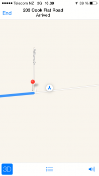
Was driving down the road, Apple Maps kept yelling turn right.
 

Attachments

  • AX5YbVc_gGbKnQrGXTwAWbB4AeAs.png
    AX5YbVc_gGbKnQrGXTwAWbB4AeAs.png
    51.4 KB · Views: 251
  • Like
Reactions: Beeplance
And you know what's more irritating? That there is this Copyright in the Apple Maps app, and they state that maps are provided by TomTom and OSM (at least for Poland), but BOTH services has more up-to-date maps :)

Agreed. We had several new roundabouts built over the last year and a half (rural France). The first navigation app to pick it up was Waze, then TomTom, while both Apple Maps and Google Maps (!) still show the old layout. I reported it to Apple Maps three times over that period, still no change. Also reported it once to TomTom and their map was eventually corrected. Makes me wonder how TomTom & Apple Maps share their map data...
 
Having used Apple Maps (in iOS 9 & 10), Google Maps & Waze, just some of my observations on their differences, mostly for driving:

Apple Maps

Positives: clean UI / routing algorithm that seems to emphasise simplicity or convenience over speed of arrival / deep integration into iOS, e.g. use in locked screen.
Negatives: the actual map data & road layouts still have quite a few inaccuracies that do not get corrected by Apple despite repeated reports / POI database is much weaker than those of Google or Waze / the current Maps version (in iOS 10.0.1) takes longer to plan the route than Waze/Google and seems very processor resource hungry (my SE heats up and stays very hot until I begin the planned journey and for about 5 minutes into it, then cooling down to normal).

Waze

Positives: super fast route planning / real time traffic conditions updates by the users / more driving-related features (speed limits, accidents, etc.).
Negatives: heavily prioritises arrival speed, so even with the option to choose the shortest vs fastest route activated still tends to offer really strange side-roads to take. Doable, but way more hassle than with Apple routing / can still send you into the middle of reported traffic jam if it calculates that you might save a minute vs an unblocked route.

Google Maps

Positives: great POI database / more detailed maps overall
Negatives: less clean UI with small buttons to click to get to the more advanced options, e.g. avoiding tolls / some map areas are more outdated than in Apple Maps, e.g. a road that has been turned into one-way is still marked as a regular one by Google (reported it now).

I have tried all of them on a familiar route of about 80 miles (130 km) and currently alternate between Apple Maps (70%) and Waze (30%).
I should make a remark, that everyone here should enclose his or her PLACE (place of using Maps).

And I agree with everything you said about the design, simplicity and OS integration.

It's just the data that bothers me.
 
I'm in the western part of Michigan in the USA...I've been actually blown away at how quickly and accurately Apple Maps has been when requesting directions to places I haven't been to before or even on familiar routes. Accident notifications and traffic notifications seem to be spot on. I already expect that the POI's are in no way as good as Google...and may never be...but they haven't been an issue so far.

I haven't had a chance to try transit as my travels have been limited to places where it either isn't available or needed.

I do wish Maps would offer offline areas for a limited time like Google and HERE offer. I travel to Sweden every month and would love to use Apple Maps for basic navigation rather than Google even though it seems to work fine. I'm going o keep using it more and more...if anything, to test it out and offer corrections.

I'm one of those geeks that actually enjoys creating or modifying the maps in Waze and just wish I could do the same for Apple.
 
Last edited:
  • Like
Reactions: one more
I don't think there's any question that Apple Maps is not up to the same standard as Google or Waze (though, to be fair, Waze is Google). Google/Keyhole had a 10 year headstart, which makes a big difference. That being said, Apple perhaps should not offer Maps in countries where it does not have adequate data. This could cause a problem or injury/fatality, and at that point, they may relent and allow other mapping apps to become the default.

For myself, in Metro New York, I am quite pleased with the progress this app has made over the past 4-5 years. I ignored it, really, until this year, when I got a vehicle with CarPlay. I am finding that, with the exception of road hazards and police spotting, it is performing very close to Waze's standard for routing, which is my primary use for it. I also like the transit options and the ability to designate certain transit routes and stations as favorites, which makes checking schedules easier.
 
That's why I started this topic. Some US ignorants still think it's some kind of an unfunded irrational hatred without any rationale behind it.
US ignorance? It's not ignorance to say that Maps works well/better here. It just stating a fact. It looks like Poland (among other countries) is poorly supported. I'd use the services that are better in your geographical area.
 
Register on MacRumors! This sidebar will go away, and you'll see fewer ads.