Become a MacRumors Supporter for $50/year with no ads, ability to filter front page stories, and private forums.
Status
The first post of this thread is a WikiPost and can be edited by anyone with the appropiate permissions. Your edits will be public.
Apple Maps has always had more of a “higher” view compared to others as well as the “show more of the road” versus the “arrow always facing up” view.

I used to like the more “horizon” view as well...actually, the first release of Maps kind of had this...but I much prefer the way they do it now. I think they’ve done a good job with the auto zoom based on speed/next turn. I’m sure they did a ton of studies to show just enough and at the correct angle to make Maps as easy to understand as possible.

I almost wish I was still traveling as I’m absolutely blown away at how Maps is performing for me locally both from a POI standpoint and with directions.
So I’ve just been out driving and have figured out what’s bugging me so much about the current iteration of Apple maps for navigation. It’s the way it switches between birds eye and 3D ‘horizon view’. There seems to be no rhyme or reason to why or when it switches - sometimes it will stay in horizon mode for half a mile before switching to the 2D aerial view, but then other times it won’t switch out of the 2D aerial view even when I’m approaching or navigating a junction. Not only do I not like the 2D aerial view for navigation, but I also find the constant, yet inconsistent, switching between the 2D and 3D view highly distracting when driving.

I’m sure the app is being consistent with the algorithms which have been programmed, but the real world application feels clunky and non-intuitive. I’d far rather have the option to set a default view, and let the app zoom in and out of that view depending on my speed.

I’ve even started looking for alternatives. I tried the TomTom app, and even though I vastly prefer the way it renders the map, I didn’t get off to a great start as it literately sent me round 3 sides of a square for no apparent reason on leaving my house!

Any other recommendations greatly received!
Can you do a screen recording of what you are experiencing and share?

Mine is quite consistent...I think...depends on speed, approaching intersections...approaching turns...

I'm heading to a downtown appointment this afternoon and will record my trip since it takes local roads, highway, parking, etc. and see what happens...and will share on here as well for comments.
 
Thanks @MozMan68 I didn’t get any screen shots whilst driving, but there were a couple of times when I slowed right down to approach a junction and it remained in the high level 2D view, which really wasn’t helpful - then other times when it remained in 3D horizon view for long stretches, even when I was going at a consistent speed and had no junctions coming up.

I’m sure it’s working ‘correctly’ I just don’t think the way it displays the route works for me any more. If there was an option to turn off 2D view altogether I would. The TomTom app lets you chose between 3D and 2D, which would be perfect (if the app worked!)
 
It's funny, as I watched this totally boring trip to go get a haircut (only edited the beginning point and end point), I was fascinated by the way Apple Maps changes the zoom level and angles depending on how far I am from the next turn, what kind of turn it is, how fast I'm going.

This is taken in portrait mode (duh) right off my phone.

Things I noticed:
  • When the next turn is announced, the map zooms out to include the area of the next turn (notice after first turn where next direction is to enter the highway)
    • I'm sure this may change depending on the distance to the next turn.
  • When approaching the highway on-ramp, Maps zooms in closer but keeps the distance from me and the turn equal to that distance AFTER the turn as well...the turn location stays in the center of the map.
  • Once a turn has been made, Maps will go into it's "flattest" view (assuming no stops or intersections are immediately after the turn and speed is maintained)
  • Once I enter the highway, the map zooms out to show the full distance to the next split in the road (as noted above) so one can see exactly where they are going next.
  • When the highway splits, since the next turn is quite a way off, the Map simple zooms out to it's highest level and the normal birds eye view.
  • Once the next exit comes into view, Maps keeps a pretty consistent changing zoom level to slowly close the view on where I am and the next exit.
  • When I finally exit the highway, yes, it moves into a fairly consisten 2D view for the rest of the trip. I'm guessing this is because not only am I very close to my final destination, but there are many cross streets and lights.

 
  • Like
Reactions: Watom
I guess that means traffic lights and stop signs won't show up during navigation in these areas. Perhaps they can still show speed cameras and red-light cameras (if those are used there) if they manage to get data from a third-party or from official sources.
I’m pretty sure there won’t be any lights or stop signs in Alert!
 
Hey @MozMan68 - thanks for the video and such a detailed analysis of how Apple Maps presents the navigation - it's fascinating to see it on someone else's screen, when you're not also trying to focus on staying on the road! I think Apple Maps is calibrated for North America, where roads tend to be straighter, and there are longer sections without junctions (a major generalisation I realise!). Here in the UK, unless you're driving on a motorway or major A-road you're navigating windy roads and encountering lots of junctions, so the constant zooming in and out from 3D to 2D feels more jarring. Also I always like to see the junctions I'm approaching in 3D horizon view, which is probably a hang-over from the early satnav systems I used when I learnt to drive

I'll try a few more apps and see if I can find one which does what I want.. and will let you know if I do!

When you're encountering the constant change between 2D and 3D, are you driving on a road with many roundabouts?
 
It's funny, as I watched this totally boring trip to go get a haircut (only edited the beginning point and end point), I was fascinated by the way Apple Maps changes the zoom level and angles depending on how far I am from the next turn, what kind of turn it is, how fast I'm going.

This is taken in portrait mode (duh) right off my phone.

Things I noticed:
  • When the next turn is announced, the map zooms out to include the area of the next turn (notice after first turn where next direction is to enter the highway)
    • I'm sure this may change depending on the distance to the next turn.
  • When approaching the highway on-ramp, Maps zooms in closer but keeps the distance from me and the turn equal to that distance AFTER the turn as well...the turn location stays in the center of the map.
  • Once a turn has been made, Maps will go into it's "flattest" view (assuming no stops or intersections are immediately after the turn and speed is maintained)
  • Once I enter the highway, the map zooms out to show the full distance to the next split in the road (as noted above) so one can see exactly where they are going next.
  • When the highway splits, since the next turn is quite a way off, the Map simple zooms out to it's highest level and the normal birds eye view.
  • Once the next exit comes into view, Maps keeps a pretty consistent changing zoom level to slowly close the view on where I am and the next exit.
  • When I finally exit the highway, yes, it moves into a fairly consisten 2D view for the rest of the trip. I'm guessing this is because not only am I very close to my final destination, but there are many cross streets and lights.


The appearance and behavior is slightly different on CarPlay. For instance, when driving on the highway, Apple Maps starts zooming in slowly on the phone around 1.3 miles from the exit, where it's one mile exactly for CarPlay. On the phone, the 3D buildings reappear at 1.2 miles from the exit, but on CarPlay, they don't appear until 0.3 (!!!) miles from the exit.

I wonder if this has to do with Apple Maps adjusting the experience based on the size of the viewing screen. CarPlay (at least in my case) is on a decently-sized 16x9 widescreen car display.
I can't remember if I tried this before, but screen record will NOT record the CarPlay screen, only if I do screen shot, correct?

Maybe I'll take another phone and record the CarPlay screen to see the differences.
 
I can't remember if I tried this before, but screen record will NOT record the CarPlay screen, only if I do screen shot, correct?

Maybe I'll take another phone and record the CarPlay screen to see the differences.

Yeah, as far as I know, you can only take screenshots.

My next car may have an ultra wide widescreen (14.5 inches), so I'll be curious to see if Apple Maps displays any differently.
 
When you're encountering the constant change between 2D and 3D, are you driving on a road with many roundabouts?
Most roads around here have lots of roundabouts to be honest, although I haven't noticed that it happens more with roundabouts. I hadn't thought about the differences with CarPlay vs using the phone directly, but as you say there does seem to be a significant difference
 
Most roads around here have lots of roundabouts to be honest, although I haven't noticed that it happens more with roundabouts. I hadn't thought about the differences with CarPlay vs using the phone directly, but as you say there does seem to be a significant difference

We certainly have fewer roundabouts here in New York, but whenever I encounter one, Apple Maps treats it like a turn at an intersection, and thus switches to the top-down view temporarily.
 
I'll be honest i use Maps via Carplay daily and i've not noticed any issues with it zooming in and out at all. With the new map view with more detail i find it head and shoulders above any other mapping app to use.
 
  • Like
Reactions: MozMan68
I'll be honest i use Maps via Carplay daily and i've not noticed any issues with it zooming in and out at all. With the new map view with more detail i find it head and shoulders above any other mapping app to use.

I think his issue is more about it being "zoomed" to the 2D view more often than he would like...which I can totally understand.

My guess is that it does this because of the number of cross streets and/or turns he is experiencing in his commute or daily travels?

Even going through NYC streets, it stayed in a pretty high 3D birds eye view when I would travel from downtown to midtown along a single road. Only went into 2D mode when the taxi would get ready to turn.
 
Last edited:
The appearance and behavior is slightly different on CarPlay. For instance, when driving on the highway, Apple Maps starts zooming in slowly on the phone around 1.3 miles from the exit, where it's one mile exactly for CarPlay. On the phone, the 3D buildings reappear at 1.2 miles from the exit, but on CarPlay, they don't appear until 0.3 (!!!) miles from the exit.

I wonder if this has to do with Apple Maps adjusting the experience based on the size of the viewing screen. CarPlay (at least in my case) is on a decently-sized 16x9 widescreen car display.
I also wonder if the orientation of the iPhone plays a part too - Is it different if it’s in landscape or portrait mode?

Im U.K. based and I’ve never noticed a problem, although I appreciate some of it is personal preference and I use it in CarPlay mode. To me it only seems to go to ‘top down 2D’ mode on large or complex junctions-the rest of the time it just sails along in ‘3D horizon’ mode.
I've also wondered whether the phone orientation has any effect on the way it renders the view. I used to prefer having the phone mounted in portrait on the windscreen, like @MozMan68 's video, although it doesn't make sense not to use CarPlay now that I have it.
 
I've also wondered whether the phone orientation has any effect on the way it renders the view. I used to prefer having the phone mounted in portrait on the windscreen, like @MozMan68 's video, although it doesn't make sense not to use CarPlay now that I have it.
I tried landscape as well yesterday...just didn't share the video. I didn't notice a difference other than the info moving to the left side of the screen (in the USA) and the main map area to the right. Angles and zoom seemed identical.
 
  • Like
Reactions: Dunk the Lunk
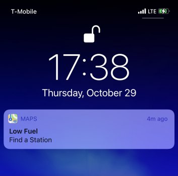
Low Fuel in Maps

I got this notification yesterday. I thought it was kinda cool.
 

Attachments

  • A40378CE-EB66-419A-80D3-D47E557FC50F.jpeg
    A40378CE-EB66-419A-80D3-D47E557FC50F.jpeg
    129.7 KB · Views: 173
  • Wow
Reactions: G1Ravage
Low Fuel in Maps

I got this notification yesterday. I thought it was kinda cool.
Dont think everyone will get that, that will depend a lot of the car maker hooking into the CarPlay system to make the prompt appear. I certainly not get it on my 2018 Vauxhall Insignia which is basically the same as a Buick Regal in the US. What car do you have?
 
Dont think everyone will get that, that will depend a lot of the car maker hooking into the CarPlay system to make the prompt appear. I certainly not get it on my 2018 Vauxhall Insignia which is basically the same as a Buick Regal in the US. What car do you have?
Ford Fiesta (U.K.) models with CarPlay have this feature. Been around for a few years.
 
Ford Fiesta (U.K.) models with CarPlay have this feature. Been around for a few years.
Didnt realise that, its a handy feature. My old Insignia had built in Nav which did something similar but i didnt bother paying extra for Nav on the new one as i knew i would just use a map app via Carplay and it doesnt pass the warning to CarPlay. I did have an insignia hire car for a while with built in nav and it passes it to that. Seems they just couldnt be bothered to tie it into CarPlay for some reason.
 
ANY car that has the ability to give a low fuel warning and has CarPlay CAN have this option. It's up to the manufacturer to turn on the CarPlay features such as low fuel warning. You can even control the environmental controls from CarPlay.

There are many other options that were released as part of iOS12 including the ability to allow CarPlay areas to be displayed on the secondary display such as behind the steering wheel...this is what I REALLY want.

I want to see detailed music info/graphics there as well as the option to have Maps show up there.
 
Last edited:
  • Like
Reactions: G1Ravage
ANY car that has the ability to give a low fuel warning and has CarPlay CAN have this option. It's up to the manufacturer to turn on the CarPlay features such as low fuel warning. You can even control the environmental controls from CarPlay.

There are many other options that were released as part of iOS12 including the ability to allow CarPlay areas to be displayed on the secondary display such as behind the steering wheel...this is what I REALLY want.

I want to see detailed music info/graphics there as well as the option to have Maps show up there.
We had a Renault Kadjar hire car whilst in France last year which had CarPlay, never had the fuel go low enough to prompt a warning but if you used the built in sat nav or via a CarPlay app it did show some directional arrows and distances on the dash behind the steering wheel as well as on the main screen. Was quite handy.

The hire car Vauxhall i had would show music stuff on the info screen behind the steering wheel if it was from the radio or streamed via Bluetooth but if you played anything via CarPlay it was blank. I think basically Vauxhall did the minimum to implement CarPlay. As an aside was playing about building a Volvo estate on their website configurator earlier....£300 option for CarPlay\Android Auto to be enabled on their infotainment system!! I'm at a point now where a car not having CarPlay would be a bit of a deal breaker, be an interesting test for the salesman to see if he was happy to let me walk away from a £30k to £50k car over £300 to enable it.
 
Any idea when the Apple Maps reviews feature will be launching? Haven’t heard anything since the limited rollout in August
 
Register on MacRumors! This sidebar will go away, and you'll see fewer ads.