Got a tip for us?
Let us know
Become a MacRumors Supporter for $50/year with no ads, ability to filter front page stories, and private forums.
The iOS14 Apple Maps Thread
- Thread starter MozMan68
- WikiPost WikiPost
- Start date
- Sort by reaction score
You are using an out of date browser. It may not display this or other websites correctly.
You should upgrade or use an alternative browser.
You should upgrade or use an alternative browser.
- Status
- The first post of this thread is a WikiPost and can be edited by anyone with the appropiate permissions. Your edits will be public.
I’m seeing this which I think are the new maps...View attachment 947815
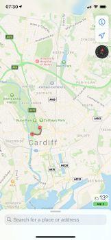
Yep, look new to me! Possible to screenshot a couple of random towns/ cities up close to get a feel for it?
Yep, look new to me! Possible to screenshot a couple of random towns/ cities up close to get a feel for it?
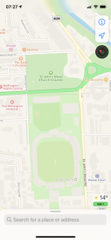
Let’s see those baseball fields!
Attachments
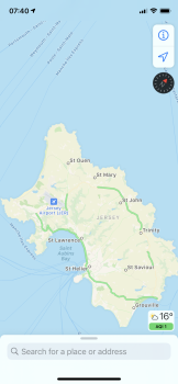
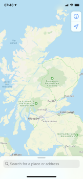
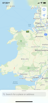
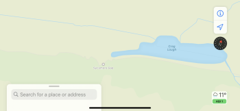
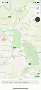
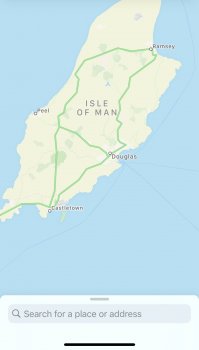
A few regional shots.
Nice that they’ve done the crown dependencies!
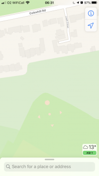
And they’ve done a decent job of English baseball fields.
Seems the overview of National Parks hasn’t changed that much.
looks to me like they have included National Trails in there too. Walked Hadrian’s Wall trail a few weeks ago and the experience wasn’t great with the old maps, this seems to have the trail which is great.
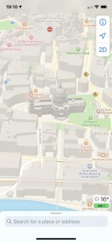
Much more detail of buildings when in 3D view on map mode. Have attached a picture of the iPad that still has the old maps on it.
Attachments
-
 BE8E9333-C856-4B6D-BCAE-4AE26FA00833.png1.4 MB · Views: 341
 -
 108C80F9-8E81-4E8F-B4AC-71866877CC6A.png1.5 MB · Views: 296
 -
 06047037-06AB-4762-AE5C-3626A6CE44E1.png1.6 MB · Views: 308
 -
 B778FA8A-2825-40A4-8BF5-166B47296CC2.png2 MB · Views: 334
 -
 DA67018B-8E11-436F-B4E3-8977FE20E774.png1.2 MB · Views: 278
 -
 6E9EF433-6DED-4102-BBD5-98269306C1F9.png1.4 MB · Views: 320
 -
 AC7841FE-AE43-4CC9-9917-308537D03972.png1.7 MB · Views: 305
 -
 200AF3B4-C96C-4A62-A66F-710D5C7DEC91.jpeg172.6 KB · Views: 279
Last edited:
Is the UK rollout appearing on iOS 13 devices or is it limited to iOS 14?
I’m on 13.6.1 (and in the UK) and can see the new maps.
Is look around available or not
I can’t see it yet-I’ve tried London and Edinburgh.
Nice that they’ve done the crown dependencies!
They haven’t done a great job with St Kilda-all of the buildings and structures are missing.
And no sign of Rockall either 😉
Posted this in bugs and changes but on the chance some of you might miss it I’ll post it here too: Installed beta 6 on my iPhone 11 yesterday, maps was active all through the night. Battery Settings is showing usage a minute at a time for each hour. But it used up about 15% of battery as of 7am Dublin this morning, hit the sack at 11pm.
Are traffic lights and stop signs shown during navigation like they are in the United States?New UK maps look smart in CarPlay....
View attachment 948215
Your specific question is one I can't answer since I'm not in the UK, but when the new maps came to my region (Midwest United States) traffic lights and stop signs did not come at the same time. There was a bit of time between the two. Just something to keep in mind.Are traffic lights and stop signs shown during navigation like they are in the United States?
So I took a look at Google Maps now that their new ground data is visible to me. They also added traffic lights to intersections. Traffic lights on Google Maps are visible at all times when browsing the map. Not just when using navigation like Apple Maps.
My thoughts on their ground data? The map looks better than it did before this update. However, if I were to think of it in terms of how it looks...Apple Maps wins. My town is green everywhere on Apple Maps. On Google Maps, you can literally see the town's boundaries. Within town limits, the only green you see is parks. The rest is just gray. When you are outside of a town's boundaries...that's when you are seeing green...until you get into the boundaries of another town. This is contrasted to Apple Maps, which has the land detail everywhere.
Google is definitely trying to play catchup to Apple on certain aspects of the map (in this case, traffic lights and ground data). On one hand, Google just released more detailed ground cover for the entire planet at once. On the other hand, what Apple is releasing at a slow pace, looks...better. I understand the slow pace may be frustrating for people, but it's paying off in my opinion.
As a user in the US...Apple Maps will continue to be my go-to. I have enjoyed it a LOT more ever since the new map came around.
Google is definitely trying to play catchup to Apple on certain aspects of the map (in this case, traffic lights and ground data). On one hand, Google just released more detailed ground cover for the entire planet at once. On the other hand, what Apple is releasing at a slow pace, looks...better. I understand the slow pace may be frustrating for people, but it's paying off in my opinion.
The way I see it, the problem with Apple’s slow rollout worldwide is that in this case they are also working on something (road layouts, etc.) that changes quite rapidly, so they will never get it perfect. Other mapping platforms do not sit still either. Google, for example, has the traffic data updates from about 80% of smartphones worldwide, plus Waze users on different platforms. That is a lot of useful data.
However, despite the fact that I am still on the “old” Apple Maps, from time to time they outsmart Google with their routing. For example, the other day a small bridge in rural France was closed for repairs. Google did not show it, while Apple Maps did. Kudos! 👍 I am just waiting for a fresh look and better POI integration now.
I think the feature showing traffic lights and stop signs could roll out across the entire United Kingdom and Ireland at once like it did in the United States when they finished the rollout of their own map there. After all, they won't be releasing these countries in segments like they did with the US. I could also see it being limited to major cities like London and Dublin at launch with nationwide rollouts after a few months.Your specific question is one I can't answer since I'm not in the UK, but when the new maps came to my region (Midwest United States) traffic lights and stop signs did not come at the same time. There was a bit of time between the two. Just something to keep in mind.
The one journey I did so far didn’t go through any traffic lights and we don’t really have stop signs like you get in the US.Are traffic lights and stop signs shown during navigation like they are in the United States?
Send a Feedback report about it. I had that issue in a previous beta, sent in the feedback, and the issue seemed to have been fixed in a following beta. I closed my report since I haven’t had an issue, but if you are...then it means it’s still out there. Hopefully it gets taken care of!My maps keeps crashing back to the home screen after starting to use the beta :-(
Send a Feedback report about it. I had that issue in a previous beta, sent in the feedback, and the issue seemed to have been fixed in a following beta. I closed my report since I haven’t had an issue, but if you are...then it means it’s still out there. Hopefully it gets taken care of!
Thanks. Did that earlier today.
Register on MacRumors! This sidebar will go away, and you'll see fewer ads.


