Become a MacRumors Supporter for $50/year with no ads, ability to filter front page stories, and private forums.
Status
The first post of this thread is a WikiPost and can be edited by anyone with the appropiate permissions. Your edits will be public.
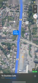
Here is another one. The directions to
Shell just stop. There are some that are literally 2+ miles away (but again, they’re fine on the old map).

I have the new maps on my iPad but not my iPhone and for me the new maps routing no longer has car ferries, I have to start from the mainland if I want to plan a route. It works fine on my iPhone. - reported.
 
FYI, there's a new poll on Justin O'Bierne's site asking which mapping app you use and why. Results aren't being shown yet because he's waiting for more responses, but it should be interesting to see how this goes!
 
I assume the Look Around footage.

Annoyingly, if I just drop a pin somewhere and get into Look Around, I can’t find a way to access it.

If I go into Look Around by just tapping on the binoculars on the main map, it shows the date in the card you can pull up in full screen.

Correct. Thanks for explaining that. Apparently I was doing it wrong. ;)
 
The “GO” button is blue now?

0672d24917ce9310df1a11445dc98232.jpg


Whoa...and while I was typing this, it changed to green.

d2d103bbd2762333fe6be920054f1a4c.jpg
 
  • Like
Reactions: TouchedByAl
"...some people may have lost them." ;)

Still having them after others get them is a good sign. Typically means it is close to being released as Apple feels comfortable enough to release without pulling away from certain "test subjects."

Doesn't mean people WEREN'T removed, but hopefully it is a good sign.


It's been nearly 2 weeks since release, so based on past schedules, The UK may see general release around the first week of October. My guess is that Canada goes into preview next with release by the end of November.
I spoke to soon.....got in the car to drive to work this morning and its reverted to the old style maps, not sure if its related to PB8 being out as i'm still on PB7. Currently updating to PB8 to see if it brings them back.
 
I spoke to soon.....got in the car to drive to work this morning and its reverted to the old style maps, not sure if its related to PB8 being out as i'm still on PB7. Currently updating to PB8 to see if it brings them back.
Sadly installing PB8 made no difference and i'm still stuck with the old maps. :(
 
Sadly installing PB8 made no difference and i'm still stuck with the old maps. :(

Yeah...has nothing to do with that...but on a positive note, history shows that having it and losing it this far in means they are probably no more than halfway to wide release. An August 22nd preview release would typically indicate wide release the first full week of October, but maybe it will be quicker since they've had a lot of practice with the USA?

I'm really hoping the average 6 week test cycle we went through over here will be reduced to 4 weeks for countries being released this year and then full swaths of regions being released next year with only a 2-3 week preview period.
 
I'm not sure how long it's been there, since I haven't really focused on Germany when I check the maps, but I decided to browse around Europe and noticed a lot of new (to me, at least) green. Not "new maps" green, but more national parks than I recall seeing previously. Again, not sure how long it's been since that was added, but it's new to me 😂

And, I don't know for sure, but when looking at Canada, it seems like more water is visible from farther out zoom levels.
 
More and more the design of AM in comparison to the latest GM is ... eye numbing.
See the example below:
271E4C95-0465-43DF-A26A-9F6B851FEC77.png2BC2BCC5-E49F-40E8-8863-284EDC533EEF.png

It is becoming common in AM, in an attempt to make AM look “pretty?” actual visibility for many items has decreased. I was just looking at the route for highway 46.

Apple needs to do something to make the actual routes a bit more “seeable”.
 
More and more the design of AM in comparison to the latest GM is ... eye numbing.
See the example below:
View attachment 952878View attachment 952877

It is becoming common in AM, in an attempt to make AM look “pretty?” actual visibility for many items has decreased. I was just looking at the route for highway 46.

Apple needs to do something to make the actual routes a bit more “seeable”.

I think it really has to do with Apple’s attempt to focus on usage for routes/directions and searching for POI’s than to imitate a traditional paper map like Google.

I mean, the info is there, Apple definitely uses different zoom levels than Google to show certain details.

They want you to search for POI’s and give you the best, nicest looking graphics to get there.
 
  • Like
Reactions: compwiz1202
I think it really has to do with Apple’s attempt to focus on usage for routes/directions and searching for POI’s than to imitate a traditional paper map like Google.

I mean, the info is there, Apple definitely uses different zoom levels than Google to show certain details.

They want you to search for POI’s and give you the best, nicest looking graphics to get there.
Zoom was one of the main reasons we nixed GM after trying. Zooms way too close sometimes. Especially on curvy roads. Like to see the curves ahead to get a feel of how the road will go. And was better and worse with lane guidance. It was more accurate on exactly which lane sometimes instead of saying to be in one of two lanes. But it always did it way too soon. We'd be like three or more exits before the exit, and it would show be in the right lane already. If you would listen that soon you would be forced off the wrong exit. I one cool feature I found in GM on carplay was a way to adjust the volume. It would read this long thing about adjusting volume so you could adjust it then instead of when you are driving and it talks. And GM seemed to give better routes. If they would just fix the zoom and the early guidance, we might try again.
 
Zoom was one of the main reasons we nixed GM after trying. Zooms way too close sometimes. Especially on curvy roads. Like to see the curves ahead to get a feel of how the road will go. And was better and worse with lane guidance. It was more accurate on exactly which lane sometimes instead of saying to be in one of two lanes. But it always did it way too soon. We'd be like three or more exits before the exit, and it would show be in the right lane already. If you would listen that soon you would be forced off the wrong exit. I one cool feature I found in GM on carplay was a way to adjust the volume. It would read this long thing about adjusting volume so you could adjust it then instead of when you are driving and it talks. And GM seemed to give better routes. If they would just fix the zoom and the early guidance, we might try again.

I agree with everything you are saying (except I have no issues with Apple’s routing)...but I think his issue is what the map simply looks like and the clarity of it when just looking at it; not while routing anywhere.

I know it seems a little crazy, but Apple is so forward thinking, I think they designed Maps as I stated in my post above. Looking at a closer, more detailed level when not routing or just routing. Doesn’t work too well as pointed out at the zoom level in the example above when wanting to review like a paper map. But I think that’s by design.

But people who never used paper maps before (anyone younger than 40 most likely) wouldn’t know what they are missing since there is no reference point and they use Maps in a different way.

Just my best guess/opinion though...kind of stuff I’d love to know for sure from the Apple Maps team.
 
Last edited:
  • Like
Reactions: dk001
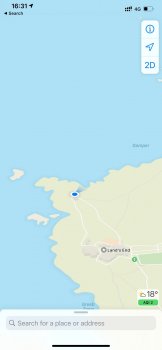
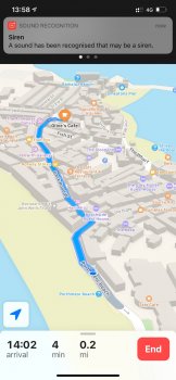
If anyones interested, I thought I’d share my ‘New’ Apple Maps experience in the UK, after a long car journey from the outskirts of London to Cornwall & then further down to Lands End.


As someone that uses a mixture of Apple Maps, Google Maps & Waze - I wanted to put the new Apple Maps to the test fully. Involving 4 hour / 4 & half hour car journey, 51 thousand steps & various uses of public transport.


Firstly to cover all of the positives I found -

  • Building outlines are absolutely everywhere & appear relatively up to date; even the tiniest shed in the most rural location or public toilet
  • Walking directions are extensive, in most cases more so then Google Maps. With all footpaths mapped out through Cornwalls areas of outstanding beauty, coastal paths even the tiniest of entrances. Almost as if they have acquired this data from Ordnance Survey. Even alleyways between buildings in small villages. This makes walking with Apple much more reliable, rather then just guided to walk straight over a busy A road when there is a perfectly good over or underpass
  • The zooming in & out around junctions is perfect & the way junctions are shown is great, even if there is sometimes a slight lag
  • Car parks are more accurate in respect to arrival entrances & navigation within car parks; only part missing here - is integration with Ringgo, Just Park & Paybyphone.
  • Detail of signs used within navigation, for example on busy A or M roads in the UK - it seems to lift the detail from the signs. Ie. Take the exit towards Thorpe Park & 'X', information that I assume could only be lifted from the sign or by using a attraction on the m

Negatives / Improvements -

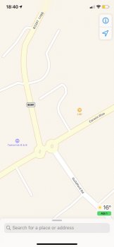
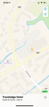
  • Mini Roundabouts for some reason no longer exist in the UK; Old Apple Maps ex Tom Tom data had them all mapped perfectly. But new Apple maps classes them as a right or left turn
  • Arrival destinations in many locations are some way off in some places (as mentioned by others above)
  • Multiple stops, this is desperately needed. I know there is a work around, but really need the flexibility of this feature.
  • Speed Limits are incorrect in many places & its very difficult to correct, other then reporting to Tom Tom & remembering the exact part of road that was wrong
  • In some locations, turnings are made up. For example, driving on a straight road with a bend, sometimes is a classes as a right or left turn - when realistically is not the case.
  • Public transport, despite Live transit being available in the UK. I’ve rarely seen the location of a bus or train appear live on the map as is often seen in the US. Maybe its just very very niche?
  • Satellite imagery is still very poor & in some locations blurry, which can be a challenge if using solely satellite view rather then standard maps
  • Public transport platform information, this is sorely missing & would be extremely useful
  • EV Charging, whilst I didn’t make use of myself. Availability information of chargers would be useful & is hopefully coming with Apple’s EV dealer partnership

In case anyone asks I have reported all of this to Apple :)
 

Attachments

  • IMG_1126.jpeg
    IMG_1126.jpeg
    72.5 KB · Views: 190
  • tempImageHcjFIY.png
    tempImageHcjFIY.png
    5.3 MB · Views: 203
  • IMG_0885.jpeg
    IMG_0885.jpeg
    193 KB · Views: 194
  • IMG_1156.jpeg
    IMG_1156.jpeg
    38.1 KB · Views: 182
  • IMG_1155.jpeg
    IMG_1155.jpeg
    121.3 KB · Views: 217
  • IMG_1148.jpeg
    IMG_1148.jpeg
    234.8 KB · Views: 204
Great overview. Thanks for taking the time to note all of this. And as you know, some of your negatives are “wish they had” and not actual issues with the map...but I don’t think many would disagree.

I’m surprised by the speed limit one though. The new Maps uses the data from the Apple car “reading” the speed limit signs as posted and was WAY more accurate in the US after new Maps was introduced versus the older government supplied info.

I think you’ll experience rapid improvement in some of your negative observations as it took a few weeks for some corrections to Maps to really kick in...especially since you are still in the pre-release.
 
I agree with everything you are saying (except I have no issues with Apple’s routing)...but I think his issue is what the map simply looks like and the clarity of it when just looking at it; not while routing anywhere.

I know it seems a little crazy, but Apple is so forward thinking, I think they designed Maps as I stated in my post above. Looking at a closer, more detailed level when not routing or just routing. Doesn’t work too well as pointed out at the zoom level in the example above when wanting to review like a paper map. But I think that’s by design.

But people who never used paper maps before (anyone younger than 40 most likely) wouldn’t know what they are missing since there is no reference point and they use Maps in a different way.

Just my best guess/opinion though...kind of stuff I’d love to know for sure from the Apple Maps team.

You are correct. :)
Plan a trip.
Explore areas.
Get directions.

Planning a trip is the area that Apple fails in.
 
  • Like
Reactions: compwiz1202
On a couple of the negatives I use Apple Maps a lot and on both the older style and the couple of weeks i had on the new style maps, UK based, i cant say i've ever had an issue with speed limits and they are normally pretty accurate. On the times you see a sign post Maps will update just after you pass the sign. It was actually rather annoying that when i was on holiday in France and was using Apple Maps via CarPlay it didnt show the speed limits even when i had directions running. Also i cant say i've ever noticed an issue with mini roundabouts when i've been using it, i've even just checked a few near where i am and they are all showing as roundabouts.

I have had a couple of occasions where the final destination is not quite right on the map plus when i navigate from our house to the in laws to drop the little one off in the morning, more for traffic updates than directions there is one part where it always just says i have 2 and a bit miles to my destination and it fails to notice that about halfway there is a junction where i need to turn right, for some reason it just thinks its on the same road the whole way. Done this for ages on old and new maps.
 
Planning a trip is the area that Apple fails in.

Ugh...I know...

With the release of Guides, I'm hoping that they are somehow one step closer to releasing a web-based application of Maps and the ability to do multiple stops.

Either that or it's one step further away as they are expecting people to open Guides when they are actually in that area and use them to find stuff on the fly without pre-planning anything.
 
  • Like
Reactions: dk001 and iOS Geek
Ugh...I know...

With the release of Guides, I'm hoping that they are somehow one step closer to releasing a web-based application of Maps and the ability to do multiple stops.

Either that or it's one step further away as they are expecting people to open Guides when they are actually in that area and use them to find stuff on the fly without pre-planning anything.
I do hope that Guides are a sign of things to come. I browsed through the ones they had for San Francisco in the beginning and I really liked it. Just recently looked through the ones for Chicago. Having grown up in the Bay Area and currently living in the Chicago area...I thought I knew everything there was to know! However, there are quite a few places in the Guides for both cities that I've never even heard of, but that I would definitely like to visit thanks to seeing them called out. This could be HUGE for businesses.
 
  • Like
Reactions: dk001 and MozMan68
Register on MacRumors! This sidebar will go away, and you'll see fewer ads.