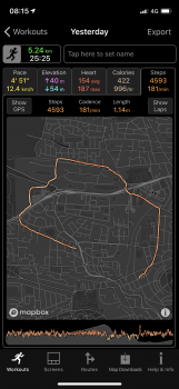
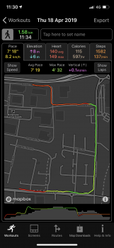
Long distance road test....PASSED !!
https://www.strava.com/activities/2418628822
Well...I completed the “Escape from GB” ultrarunning race starting at midday on Friday from Haltwhistle (the geographic centre of Great Britain), the object being to get as far away as the crow flys as possible by midday Sunday.
I knew I couldn’t really run that far continuously (there was a runner with Marathon de Sables and Barkley Marathon experience, and even he had to drop out before the 48hrs was up, to avoid serious injury)...so made the decision to have an actual bed for both nights (some people ran through the night), and planned a route where I’d more or less finish by the Saturday evening, barring a short walk and a boat ride on the Sunday morning to notch up a few more miles....a BOAT ride?! Yes...one caveat to the “on foot” rules was a proviso that runners could cross the sea, to be categorised in a special “Islander” category for the runner who ‘escaped’ (the virtual crow) the furthest distance and reached somewhere beyond the mainland.
Anyway...an incredibly slow Friday afternoon had me safely in the pub I was sleeping in about 2hrs behind planned schedule, the hills and wind and rain and boggy Northumberland Forest slowed me down a lot more than I’d hoped! Saturday was mainly country road surface (barring the odd few miles of farmland and river crossings), but my tired body and lots of walking up hills again lost me about an hour across the full day compared to what I’d hoped for. But, I’d made it.
Sunday as I say was easy, a walk to a harbour, sit on a boat and then marvel at thousands of puffins and seals...amazing that I’d got there effectively under my own power after starting about as far away as it’s possible to get from the sea. Oh...and I WON the Islander category, being the only person stupid enough to attempt a sea crossing!!
Route had been planned and refined on the MapOut app on iPad over a period of a few weeks (with lots of reference to Google maps...it’s a shame that MapOut doesn’t have a toggle for Satellite imagery), with WayPoints added for my end of day bases, plus WayPointed a pub halfway through each day where I planned on a 30-45 minute recharge.
MapOut was good for reviewing the route at the start of each day and having a quick glance of elevation...and towards the end of the second day I used it a couple of times to double check how far I had left to go.
BUT...in the main, I ran the whole thing solely relying on WorkOutdoors....navigating through barely marked dense forest paths, along miles and miles of roads I’ve never been before, and across public footpaths and bridleways that criss crossed open marshy moorland that looked pretty much the same in all directions.
It performed brilliantly!
Since I had my phone I left them paired, and I decided to leave heart rate tracking enabled. After the first 4hrs, I just stuck my watch on the charger (with a mobile powerbank) and got a 20 minute boost whilst I had a sugary soft drink (and a not so soft one)...that got me back to 100%...and I ran the remaining 3 or 4 hrs on Friday without even really checking the battery.
Similar story on Saturday...I set off running at 9am...recharged in a pub at 1pm, and had plenty juice left when I finished running around 630pm...battery drain was probably quite a bit less on the Saturday as the long roads meant I only really had to navigate at junctions so didn’t really look at watch that much...barring one incident where there was a bull blocking my route so I zoomed out the map (on watch, didn’t even bother with phone), and quickly worked out a way around to join back up with my plan via a brief diversion.
So, I had four activities, (plus one I created on the Sunday morning), I’d disabled my auto syncing to Strava via HealthFit, simply exported them from WorkoutDoors and glued them together with
https://gotoes.org/strava/Combine_GPX_TCX_FIT_Files.php ... and all was done! Maybe merging / splitting activities in the phone app is something that could be looked at in future??
The ONLY slight niggle I had really was a few times up on the hills with rain and mist, I guess rain must have been interpreted as a touch on the screen or something, as when I glanced at the watched, I wasn’t centred, and had to wipe the screen and try and dry my fingers to press the button to recentre to my location etc...I had this perhaps 4 or 5 times...on the Friday, and it was quite frustrating...implementing / fixing the screenlock (so screen touches do nothing but the crown can zoom in and out of the map), is a must-have I reckon. In the dry weather on Saturday I had no problems whatsoever, and it was actually a relatively pleasant experience to glance at my wrist and just zoom in and out with the Digital Crown every now and then if I needed to get an idea of what was coming up.
Having an “estimated finish time” field based on average pace, and either grabbing the remaining distance from the activated route, or manually entering a distance before starting would have been handy I guess...when you’ve been plodding through ankle deep mud for 2hrs or knee deep nettles for 30minutes, your ability to calculate time does kind of go out the window somewhat, and it’s nice to have some kind of target to aim for, and then adjust that target once the reality hits you that you run a lot slower than you think once you start doing long distances!
(Oh yeah, I also rather stupidly ran 18miles the day BEFORE this race started, having dumped my car near to where I aimed to finish, I ran to the nearest train station, again on a route planned on MapOut and just using WorkOutdoors to find my way!! Again, having that “expected finish time” would have been useful here as I was trying to run as conservatively as possible but make it for my train time...and I had no real idea what that meant in terms of working out the required average pace!
So thanks...great app, I think Ive tested it to the extreme and it’s passed comfortably!
Nothing crazy planned until next year at least...so I know WorkOutdoors can easily match any challenge I throw at it in the meantime


